 Lake, and then driving up 8 miles of bumpy, gutted Road 6160 to the Summit Lake trail head. We nearly missed the trail head sign, which was marked "Windigo Pass 13/Diamond Peak Wilderness ->/ Willamette Pass 17". The temperature was about 50 degrees Fahrenheit, but the mosquitos started attacking as soon as we were out of the truck. Not to mention, my new backpack was soaked through with water that had leaked from one of the water bladders I had brought. Not exactly the way I had wanted to start the day.
The first 3.3 miles of the PCT was through a forest of lodgepole pines and small ponds/lakes. With the exception of an occasional sneak peak at
 Diamond Peak from the south, you wouldn't know that we were only about 6 miles from the summit. This part of the trail was relatively flat. In just over an hour, we were at the Rockpile Lake/Marie Lake junction crossing. Another 1.2 miles through much of the same scenery, we arrived at a glorious viewpoint with views south to Summit Lake, Cowhorn Mountain, Sawtooth Mountain, and Mt. Thielsen. An exposed rock pile here with relatively flat granite rocks made a great resting point. This was also the final "easy" section before the actual "hard" ascent began.
 A few yards from the viewpoint, D spotted the rock cairn that marked the beginning of our detour from the PCT and ascent to the summit. This was also one of the few places where we saw tall, pink flowers growing along the trail. The marked change in elevation gain took effect almost immediately. Breathing became harder and more frequent breaks were required. This was going to be a very long 2 miles... Not too far onto this open ridge, the forest started to thin out as
 timberline drew closer. Pretty soon, the dry pine forest gave way to red lava rocks and sand, with a few bushes and small trees scattered here and there. Even with our trekking poles, the slippery slope made it challenging to keep our footing. We would later find out that this was the easier part. It must've took us at least an hour to hike up this section. At each small break, I'd look back south toward where we were just minutes before. The view only got better and better. We were starting to see more and more of the valley below us. Crescent Lake and Odell Butte to the east, and unknown hills and exposed old clear cuts were visible to the east. From cairn to cairn, we trekked slowly up the mountain. We would look up toward the ridge top dreaming of the rewarding view at the top and how great it will feel once we get there. Cairn to cairn, one by one. Cairn to cairn, one after the other. I wondered how the pine marten that we saw managed to dart around in this kind of terrain.
A long, snow field was situated in gully to our west. As we ascended up the south side, an occasional cold breeze would blow in from the west. We could see what laid ahead of us -
 more scree, but the granite, very slippery, very sandy kind. We were about 1/4 mile from the ridge crest when the grey, slippery, sandy scree began. Each step up meant another 1/2 step slide down because of the slippery slope. Certain sections here were near vertical. I guessed that the angle we were climbing was anywhere between 65-75 degrees. Although the exposure wasn't bad at all, the steepness of the climb started to have an effect on my acrophobia. At one point, I asked D to stay closer to me because I felt like I was going to slip and fall along the way. We finally reached the ridge top after what seemed like forever.
 This was a great place to catch our breath. A small rock wall shielded us from the wind blowing from the southwest while we snacked on trail mix and enjoyed the views.
 Here, we could see the trail toward the false summit with the gendarmes and the eastern slope of Diamond Peak. The eastern slope is made up of pointy, sharp-looking rock spires at the top and long, steep glaciers on the slopes that stretched toward Odell and Crescent Lakes. It was difficult to gauge just how far the actual summit was since it was hidden by the grade. The rocks and dirt here began to resemble chunks of red/pink chalk and chalk dust. White, puffy clouds were floating by as I snapped up more pictures of this beautiful day. Just reaching this point was making me even more excited about the summit that lay ahead.
 We started to trek across the saddle and immediately ran into a dead end at the first gendarme. We realized that though this was a popular viewpoint, it didn't lead to the summit. The actual summit trail was about 6 feet below us on the eastern slope. We backtracked about 15 feet and found our way down. As we re-approached the first gendarme from the lower trail, D became concerned that the only way around might represent too much exposure for my acrophobia to handle. So I stepped ahead of him and peeked ahead at the route. With a little maneuvering, I easily made my way around the rock by clinging onto cracks in the rock and stepping around. The next two gendarmes were similar and just as easy to get around with a little scrambling. At the false summit, the rocks were entirely pink/red against the blue sky. It was like looking at a giant reddish upside-down ice cream cone. Near the top was a small brass memorial that marked the life of an earlier climber in 1974. We looked back at the trail we came once again before making our final push for the summit.
 Less than 1/2 mile later, we made our mark. This was D's 2nd ascent, the last time being when he was a teenager, and the first for me. After we hugged each other to celebrate, I dug out the red tin can that hid the summit register where others before us had made their mark. The register was basically a mish mash of miscellaneous note pads and pencils in a broken glass jar. I wrote our names in the register, took a picture for my scrapbook, and proceeded to enjoy the 360 view. To the north, I could see two of the Three Sisters, Three Finger Jack, a faint Mt. Hood, Waldo Lake, and the bare ski runs at Willamette Pass where I've snowboarded many times before. The very top of Mt. Yoran near where D and I visited Divide Lake two weeks prior was also visible to the northwest. Of course the Summit Lake and beyond view that we had been enjoying the entire route up came full circle. Though there wasn't a geological marker at the top like many other peaks, we figured that we had gained about 3100 ft in elevation. We spent some time exploring, taking pictures and goofy video clips for about a half hour before beginning our descent.
 PS markings earlier to make sure we wouldn't miss the PCT corner on the way down, the rock cairns and pink marker ribbons helped us find our way back to the PCT, to the exact spot we left even! Another break here on the flat rocks to relieve our feet and rest while we watched a golden mantel nibble on its loot. The last mile of the trail seemed to have taken forever. The small ponds and lakes we saw during the first part of the hike earlier in the day now seemed to be mocking our tired bodies. At one point, D joked if new ponds had cropped up while we were gone.
Nine hours and 57 minutes, 12 roundtrip miles of pine forest, scree, lava rocks, and 3,104 of elevation gain/loss later, we returned to Summit Lake trail head where D's truck and two cold beers awaited us in the cooler...

2 comments:
Was that your tune up for Quandry? The hike is much shorter, but if we drag you up the west ridge more exposure. we'll just drug you with some muscle relaxers and have johnnyboy carry you up! He'll probably love the workout :O)
WAHOOO!!!! You two rock. That sounds like much more fun than my yumm bowl factory job.
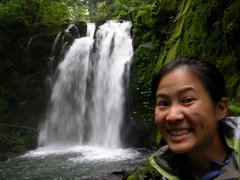
I like the self picture pic of you two.
You are so active geesh.
Ask me about Crater Lake for Labor Day.
Post a Comment