Two weeks ago to the day, I had a bone spur removed from the tip of my right tibia. Of the half dozen nurses and medical personnel I saw that day, the one that was supposed to put in my IV tried 3 times before she got it in correctly on top of my left hand. I now have a track of needle marks and a long bruise on my left arm to show for it.
Two weeks ago minus one day, I got a fever. I was feeling chills, then hot, then chills, then hot over and over again for most of the morning. My temperature shot up a full degree to 102.8 in one hour while I waited for the surgeon's office to call me back. His office called back and told me I must've gotten the flu. Call my primary care physician for help instead.
Two weeks ago minus two days, I took my first shower after surgery. It felt grrrrreat! My fever broke later that day and I finally got a good night's sleep in a warm bed.
Two weeks ago minus three days, I started walking a bit without the aid of crutches. I limped and hobbled around my house. I looked outside and saw the beautiful sunny weather. I sat near the window wishing I could go outside and play while my butt got sore and achy from having to sit all day long. At night, D drove me to Target to get some sundry items. I got to yell at D to slow down and wait for gimpy me to catch up.
Two weeks ago minus four days, I took my first stroll around my neighborhood in the beautiful Northwest fall weather. Many leaves had fallen, orange, yellow, red.. all brilliant colors. It was sunny with a gentle crisp in the air. Man, I never knew it could take so damn long to walk a single mile!
Two weeks ago minus five days, I continued to ice my ankle, stretch my achy butt muscles, and rested some more.
Two weeks ago minus six days, I drove my car for the first time in a week. I went to the bookstore. I went to the Starbucks down the street. I went to watch my team play basketball and cheered them on as they won in double OT then sudden death. I took a few sips of a glass of reisling by a warm wood stove, ate tater tots, and talked with my friend for a while.
One week ago to the day, I returned to work, only to find out paperwork issues would send me back home later that day. Then I baked some chocolate chip cookies.
Six days ago, I realized that listening to classical music helps me read. I bought a new Mozart CD and played it over and over and over again while I read. And I thought about how much enjoyed playing the piano when I was little. And how much I missed having my cherry colored Yamaha upright.
Five days ago, my doctor told me I can start doing rehab exercises and return to work. But he also told me to slow down and let my ankle heal. But I can do some resistance exercises and even bowl. Maybe some running on a treadmill or EFX in two more weeks and then maybe basketball or volleyball in four more weeks. I was so excited I couldn't wait to tell D when I got home.
Four days ago, I returned to work. It was a very long day and I felt quite stressed out. I left work at 6:15pm, went home, and had some chamomile tea to help me sleep.
Three days ago, it was Friday again. Work was a little better that day. I felt more caught up with work. D was away hunting. I went bowling with my teammates, did very very horrible bowling-wise, but had some great times laughing at myself with my bowling friends. I went home, had some more chamomile tea, and fell asleep.
Two days ago, I woke up at the normal time, made paper plate awards and went to watch a basketball game with A. Then Dad came and joined me for the 2nd game. It is always fun to watch games at MacCourt. The scoreboard shakes when the crowd gets really loud. I went to the store and bought some food for dinner. Chamomile tea was my nighttime friend once again.
One day ago, it was my last day of freedom. Oregon was ranked #2 in the latest BCS. I watched the Arizona State women play basketball and wished I could play like them. At the gym, I tried to bench press, but my left shoulder wouldn't let me. But I got to sweat for a while on the stationary bike, worked out my upper body and abs, did resistance band exercises for my ankle, and felt good about my day. D came home from his trip and I was no longer lonely again.
Things are back to normal... kind of
Monday, November 12, 2007
Monday, September 10, 2007
Mt Defiance

Every hike is a little bit different. Some have panoramic views of mountains, lakes, and valleys. Others offer the serenity and isolation from everyday civilization. For this one, just let the pictures do the talking...
Date: Saturday, September 8, 2007
Destination: Mt. Defiance summit, 5,584 ft, highest point in Columbia Gorge
We began our day at the Starvation Creek trailhead, which sits neatly alongside Interstate 84 about an hour east of Portland. Our goal was to hike up the Mt. Defiance Trail to the summit, then return via Warren Lake and the Starvation Creek trail.
The trail began by backtracking and following the interstate for about 1/4 mile to an area anchored by several beautiful waterfalls. According to my hiking book, Hole-in-the-Wall Falls (see on left) was created when ODOT diverted Warren Creek through a tunnel in an adjacent cliff. There's also a cool little tree shaped like a wishbone that is quite fun to sit on and take silly pictures.

About 1/2 mile further along the Mt Defiance trail is Lancaster Falls, which actually runs into the trail's path. Its fan-like shape reminded me of Sahalie Falls along the McKenzie Highway, but with less greenery. While I was attempting to take a photo, an excited dog ran up the trail and startled me! Not too far past this pretty little stretch of waterfalls, the trail steepens as it climbs the ridge along the Columbia Gorge. Views of the river below were pretty awesome on this clear day.
 After about 2.5 miles of unrelenting switchbacks, a short spur from the trail leads to a small viewpoint. I am not sure what the peak is immediately across the river, but it provided for some great shots. If you look carefully, Mt St. Helens can be seen in the distance. Switchbacks continue for 2 miles or so up the ridge before emerging onto the shoulder of a talus slope. From left to right, views here include Mt St. Helens, a distant Mt Rainier, and a slightly obscured view of Mt Adams. It was a nice change from the dense forest earlier.
Falls colors were already settling in as we passed a huge talus field about 1 mile from the summit (less than 1/4 mile before the summit trail cutoff). The microwave towers on the summit were clearly visible from this point. Here, the Gorge view extended from Hood River to The Dalles in the east.
 Somewhat anti-climatic, the summit was anchored by a couple of small utility buildings, microwave towers, and some unsightly backhoes and port-o-potties. What a terrible way for a first time view! There is also a dirt road here from somewhere down below for those who want the view, but not the work. We walked around to the southeast side of the summit and was captivated by the panoramic views of Mt Hood and the valley below. Like many other places in Oregon, golden mantle ground squirrels ran amok begging for food from hikers. We posed for summit pictures and refueled on my sister's yummy peanut butter sandwiches before beginning our descent.
 We chose an alternate route from the summit that took us around the west side for an overview of Bear Lake. Lots of talus crossings here, but very level and easily followed. Back on the main trailhead we went toward Warren Lake, a little slice of heaven on the shoulder of Mt Defiance. The shores are dotted with several cozy campsites. Although we didn't see any actual fish in the lake, the made their presence known with occasional water bubbles here and there.
We took the Starvation Ridge trail for the return trip to the trailhead.  The scenery was quite different from the Mt Defiance trail along the other ridge. The forest floor here were much more open and the ground covering much greener from the additional sunshine. About 1.5 mile from the trailhead, around 7:30pm, dusk began to set in, gradually dimming what light there was on the forest floor. The ridge was a bit steep and slippery in places. Luckily, I had brought my trusty headlamp to guide us down the ridge. I would trek ahead of my sis and bro-in-law a few yards, then shine my headlamp back along the trail so that they can follow suit.
 The scenery was quite different from the Mt Defiance trail along the other ridge. The forest floor here were much more open and the ground covering much greener from the additional sunshine. About 1.5 mile from the trailhead, around 7:30pm, dusk began to set in, gradually dimming what light there was on the forest floor. The ridge was a bit steep and slippery in places. Luckily, I had brought my trusty headlamp to guide us down the ridge. I would trek ahead of my sis and bro-in-law a few yards, then shine my headlamp back along the trail so that they can follow suit.
 Just before the final series of switchbacks began, we reached an exposed viewpoint that overlooked the Columbia River and the interstate below. The night view was beautiful. I'll bet it is even better and more dramatic than the daylight view. Around 8:30pm, we descended onto flat ground for the main trailhead.
Monday, September 03, 2007
South Sister
 Yes, I knew that I wanted to hike the South Sister at some point. Yes, I hadn't planned anything for Labor Day weekend. And yes, I was still feeling pretty satisfied after summiting Diamond Peak earlier this month and then going out to Colorado to hit a 14er. I thought it would be a real stretch trying to squeeze in another hike on my to-do list this summer, but heck, it was a three-day weekend after all...
E and I arrived at the Devils Lake TH shortly after 8:30am on Sunday, September 2, after a 2 hour drive from Eugene. As anticipated, the parking lot was already overflowing with cars and hikers alike. I maneuvered my little hatchback into a spot on the side of the road, strapped on our gear, and we were on our way up the South Sisters Climbers Trail by 9am. A bubbling brook led the way just a few hundred yards from the trailhead. The first portion of the trail climbs steadily through a hemlock forest via a series of switchbacks. It was way past wildflower season, so the elephants heads that I had hoped to see were no where in sight. Just the quiet shuffle of our footsteps and trekking poles tapping against the dirt.
 Shortly after a large rock wall, the trail emerges onto the edge of an vast, open, sandy area. From the research I had done, this area was the remnant of a glacier that used to cover the entire valley. When the glacier receded/melted, it left this vast "moraine". Here, Broken Top and South Sister came into view. I had seen Broken Top many times from my car, but never this close. We even noticed a rock formation on the western slope that resembled an eagle spreading its wings (you know, like random cloud formations). The South Sister approach view, on the other hand, was totally
 not what I had expected. The only views and pictures I've ever recall seeing of South Sister were usually snow-topped and almost always with the Middle and North Sisters in tow. The peak I saw on that day was quite bare, with several glaciers dotting the higher elevations, and topped with red cinder like Diamond Peak. I caught myself thinking: "boy, this wasn't quite what I had thought South Sister would look like up close..."
 We trekked across the plateau, pausing for occasional pictures and gawking time. The moraine was relatively level for the most part. The sky was this deep dark blue color that was almost purple. I kept on finding myself admiring the scenery. It was kind of like high desert, but with a different kind of isolation. Almost as if I was on a different planet. Not quite sure how to describe it. An occasional wind-gnarled trees stood watch over the landscape.
At the far end of the plateau, we left the moraine and began to ascend
 a small talus slope, about 2.3 miles from the summit. About a third of the way up the slope, E stops abruptly. Being the more experienced hiker of the two, I figured that perhaps the trail was not well-marked in this area and she didn't know where to proceed. As it turns out, E just discovered that she has a profound fear of heights! Her legs had froze and she was starting to panic. As a fellow acrophobic, I knew the exact feeling she was describing to me. I was somewhat surprised since I figured that if acrophobia was going to be a problem, I would have been the first one to know about it. Instead, I found myself in unfamiliar territory as I encouraged my hiking partner to take deep breaths and re-assured her that I would not let her fall. Step by step, I continued to encourage E and reassure her safety. A few minutes later, we were at the top of the small ridge celebrating her success.
 We continued on the talus slope, which was marked with an array of volcanic rocks and rock piles to the west and a diminishing treeline to the east. At a small saddle that overlooked a grayish-green pool below the glacier terminus, we stopped to refuel before attempting the next portion of steep cinder scree. Ground squirrels ran amok here looking for handouts. The wind was blowing at a pretty good rate here, so we zipped up windbreakers and put on gloves before moving on.
The ascent up the red scree was challenging because the slope seemed to go on forever. It was quite the calf workout, steadily sucking away the strength in my calves all the way up. I tripped several times from what I am guessing
 was fatigue in my leg muscles. The wind was blowing harder too, at times, whipping my own hair against my face. Other times, it would blow so hard that I felt like it was going to blow me off course, if not off the slope completely. E admitted that she was beginning to understand why I had made her carry heavy jacket and warm clothing up the trail, even though the temperature was easily in the 80's at the lower elevations. As we trudged up the mountain, descending hikers kept on telling us we were almost there. It was one of those things where everyone cheered each other on because they've all experienced and know what you were going through. At this point, it was difficult to gauge the distance to the summit because we could only see the edge of the false summit, which we would come to find out was the edge of the crater rim.
WOW! The South Sister summit consists of a wide crater rim
 adorned with black lava rocks and a 1/4 mile wide glacier in the middle with a steep drop on the west edge. The actual summit is a rock formation at the north end of the crater rim, immediately across from where the cinder trail had emerged. There must've been at least 100 other hikers bunkered down in the lava rock "half-igloos" that dotted the crater rim, shielding themselves from the wind. More gawking ensued before we trekked around the crater's east rim, the easier of the two approaches to the summit.
Summit views were awesome! Middle Sister, North Sister, and Mt Jefferson were visible to the north. Although it was a cloudless day, smoke from a nearby wildfire
 had obscured potential views of Mt Hood and Mt Adams to the farther north. We were many hundreds of feet above Broken Top and the backside of Mt Bachelor's ski runs. Bend and La Pine were visible below in the distance to the east. Diamond Peak, Cowhorn Mtn,
 and Mt Thielsen were also visible to the south along with the multitude of lakes that lie below along Cascade Lakes Highway. Although I am deathly afraid of heights, I found myself gravitating to the top of the summit rock to pose for a picture just to experience the exhilaration of being up there. There wasn't a summit register to leave my mark, but it was still a very rewarding ascent, which took about 5 hours.
We spent about 30 minutes on the summit before beginning our descent. Trekking across the glacier on the way back was simply amazing! A blue-green pool had formed where part of the glacier had began to melt. As the sunlight struck the water's surface, it made the pool glitter in all directions. I have walked on a glacier before, but this one was even more beautiful.
 Though much easier cardio-wise, the rest of the descent was made a bit challenging because my toes were being smashed against the toe box of my boots all the way down. My bruised heel injury from softball earlier this summer also decided to make a cameo appearance, making additional rest time necessary throughout the descent. Nonetheless, we were back at the trailhead 3.5 hours later.
Tuesday, August 21, 2007
Quandary Peak, CO
 My second 14er hike started pretty much like the last one - up before sunrise (to beat the afternoon thunderstorms) and a yummy microwaved sausage & egg croissant sandwich (to keep my energy going). The major difference being that I had flew into Denver (5,300 ft) and drove up to Breckenridge (9,600 ft) the day before as opposed to hanging out around 6,000 ft for 4 days before attempting a hike. Eugene is about 500 ft above sea level. Oh yes, and we might have had a few glasses of wine the night before with dinner....
The route that we are taking is considered a Class I hike, 6.75 miles round
 trip and elevation gain of 3,450 ft. Almost immediately, my lungs felt the impact of the altitude as we began our ascent through the pine forest. Lucky for me, Sam was the other "low-lander" in our group to share in the joy with me. A half a dozen old mining trails criss-crossed the first mile of forest. The crisp morning air was occasionally interrupted with chickorees (squirrels) calling to each other. As the sun broke across the neighboring mountains and forest, we began to shed layers of long-sleeveed shirts and warm pants. Jen would mark a point on her GPS to follow our progress at various breaks throughout the day.
 As we ascended higher onto the mountain, surrounding mountain tops come into view. Valleys with massive mountains on either side stretched into the horizon to the southeast and southwest of us. Below, several small lakes glittered in the sunlight. One small resevoir below had a long band of white marble peeking through the rockside. above us, the summit hovered above the scree and talus fields that lay ahead.
About 13,900 ft, altitude sickness started kicking in. We were less than a mile from
 the summit but the increasing nausea made progress slow and arduous. The talus and scree slope wasn't particular steep nor difficult to navigate. But the nausea made short breaks a necessity every 15-20 steps. Groups of hikers were passing us, young and old, yet there was nothing I could do to make the nausea go away and the ascent more expedient. I didn't want to slow the group down, knowing that afternoon thunderstorms are on their way, so I would signal my friends to go ahead of me. Each time, they only shook their head and continued to encourage me to keep going. What great friends I have!!!
Less than 100 feet from the summit, I began to take much deeper breaths to take in as much oxygen as possible. Distracting myself with this newfound routine seemed to help the nausea subside. At the same time, the slope began to ease a bit as we approached the summit, where many other hikers have already made their way up. I was able to actually start having conversations with my friends again without feeling like my breakfast was going to explode through my throat.
 Around 11:30am or so, we joined other hikers at the summit register recording our names, dates, and home towns. Being a popular hike, there were about 30-40 people spread all across the summit at any given time. The view south revealed 14ers Mt. Bross, Mt. Lincoln, and Mt. Democrat. The northern view revealed a large basin anchored by Crystal and Pacific Peaks with the Gore Range in the distance. A black ski lift tower several peaks over marked the top of Peak 10 in Breckenridge. Peering towards the east ridge, several hikers could be seen ascending the rock gendarmes along the Class III hike option.
Several photo opportunities and a Chocolate Chip Peanut Butter PowerBar later, we began our descent to avoid the omnious black clouds advancing towards us.
 Long stretches of rock stairs made the descent quicker and easier although many hikers were still trudging their way up the trail. We wondered if they would summit before the imminent storm hit. Our footsteps were much lighter and our joke-cracking louder now. I would look back toward the summit on occasion only to see giant black clouds casting shadows over the peak. The pikkas we saw darting around the talus fields were fewer and farther in between. They must've known that a storm was approaching. We had barely reached timberline when I felt the first drops of rain. We hurried our way down the trail as occasional rain drops and cold wind breached the sky. By 2pm, we were safely back in the comfort of the truck, relaxing in barefeet and headed back to town.
 Sunday, August 12, 2007
Diamond Peak
On August 11, 2007, D and I hiked Diamond Peak. At 8774 feet, Diamond Peak is the 16th tallest peak in Oregon. Our hike began around 8:40am, after a 1.5 hr drive from Eugene to Crescent  Lake, and then driving up 8 miles of bumpy, gutted Road 6160 to the Summit Lake trail head. We nearly missed the trail head sign, which was marked "Windigo Pass 13/Diamond Peak Wilderness ->/ Willamette Pass 17". The temperature was about 50 degrees Fahrenheit, but the mosquitos started attacking as soon as we were out of the truck. Not to mention, my new backpack was soaked through with water that had leaked from one of the water bladders I had brought. Not exactly the way I had wanted to start the day.
The first 3.3 miles of the PCT was through a forest of lodgepole pines and small ponds/lakes. With the exception of an occasional sneak peak at Diamond Peak from the south, you wouldn't know that we were only about 6 miles from the summit. This part of the trail was relatively flat. In just over an hour, we were at the Rockpile Lake/Marie Lake junction crossing. Another 1.2 miles through much of the same scenery, we arrived at a glorious viewpoint with views south to Summit Lake, Cowhorn Mountain, Sawtooth Mountain, and Mt. Thielsen. An exposed rock pile here with relatively flat granite rocks made a great resting point. This was also the final "easy" section before the actual "hard" ascent began.
 A few yards from the viewpoint, D spotted the rock cairn that marked the beginning of our detour from the PCT and ascent to the summit. This was also one of the few places where we saw tall, pink flowers growing along the trail. The marked change in elevation gain took effect almost immediately. Breathing became harder and more frequent breaks were required. This was going to be a very long 2 miles... Not too far onto this open ridge, the forest started to thin out as
 timberline drew closer. Pretty soon, the dry pine forest gave way to red lava rocks and sand, with a few bushes and small trees scattered here and there. Even with our trekking poles, the slippery slope made it challenging to keep our footing. We would later find out that this was the easier part. It must've took us at least an hour to hike up this section. At each small break, I'd look back south toward where we were just minutes before. The view only got better and better. We were starting to see more and more of the valley below us. Crescent Lake and Odell Butte to the east, and unknown hills and exposed old clear cuts were visible to the east. From cairn to cairn, we trekked slowly up the mountain. We would look up toward the ridge top dreaming of the rewarding view at the top and how great it will feel once we get there. Cairn to cairn, one by one. Cairn to cairn, one after the other. I wondered how the pine marten that we saw managed to dart around in this kind of terrain.
A long, snow field was situated in gully to our west. As we ascended up the south side, an occasional cold breeze would blow in from the west. We could see what laid ahead of us - more scree, but the granite, very slippery, very sandy kind. We were about 1/4 mile from the ridge crest when the grey, slippery, sandy scree began. Each step up meant another 1/2 step slide down because of the slippery slope. Certain sections here were near vertical. I guessed that the angle we were climbing was anywhere between 65-75 degrees. Although the exposure wasn't bad at all, the steepness of the climb started to have an effect on my acrophobia. At one point, I asked D to stay closer to me because I felt like I was going to slip and fall along the way. We finally reached the ridge top after what seemed like forever.
This was a great place to catch our breath. A small rock wall shielded us from the wind blowing from the southwest while we snacked on trail mix and enjoyed the views. Here, we could see the trail toward the false summit with the gendarmes and the eastern slope of Diamond Peak. The eastern slope is made up of pointy, sharp-looking rock spires at the top and long, steep glaciers on the slopes that stretched toward Odell and Crescent Lakes. It was difficult to gauge just how far the actual summit was since it was hidden by the grade. The rocks and dirt here began to resemble chunks of red/pink chalk and chalk dust. White, puffy clouds were floating by as I snapped up more pictures of this beautiful day. Just reaching this point was making me even more excited about the summit that lay ahead.
 We started to trek across the saddle and immediately ran into a dead end at the first gendarme. We realized that though this was a popular viewpoint, it didn't lead to the summit. The actual summit trail was about 6 feet below us on the eastern slope. We backtracked about 15 feet and found our way down. As we re-approached the first gendarme from the lower trail, D became concerned that the only way around might represent too much exposure for my acrophobia to handle. So I stepped ahead of him and peeked ahead at the route. With a little maneuvering, I easily made my way around the rock by clinging onto cracks in the rock and stepping around. The next two gendarmes were similar and just as easy to get around with a little scrambling. At the false summit, the rocks were entirely pink/red against the blue sky. It was like looking at a giant reddish upside-down ice cream cone. Near the top was a small brass memorial that marked the life of an earlier climber in 1974. We looked back at the trail we came once again before making our final push for the summit.
 Less than 1/2 mile later, we made our mark. This was D's 2nd ascent, the last time being when he was a teenager, and the first for me. After we hugged each other to celebrate, I dug out the red tin can that hid the summit register where others before us had made their mark. The register was basically a mish mash of miscellaneous note pads and pencils in a broken glass jar. I wrote our names in the register, took a picture for my scrapbook, and proceeded to enjoy the 360 view. To the north, I could see two of the Three Sisters, Three Finger Jack, a faint Mt. Hood, Waldo Lake, and the bare ski runs at Willamette Pass where I've snowboarded many times before. The very top of Mt. Yoran near where D and I visited Divide Lake two weeks prior was also visible to the northwest. Of course the Summit Lake and beyond view that we had been enjoying the entire route up came full circle. Though there wasn't a geological marker at the top like many other peaks, we figured that we had gained about 3100 ft in elevation. We spent some time exploring, taking pictures and goofy video clips for about a half hour before beginning our descent.
The descent went by much quicker than the ascent earlier but my footsteps felt so much lighter now that we've conquered the summit even though my toes were being crushed against my boots each time gravity took over each step. Although we took G PS markings earlier to make sure we wouldn't miss the PCT corner on the way down, the rock cairns and pink marker ribbons helped us find our way back to the PCT, to the exact spot we left even! Another break here on the flat rocks to relieve our feet and rest while we watched a golden mantel nibble on its loot. The last mile of the trail seemed to have taken forever. The small ponds and lakes we saw during the first part of the hike earlier in the day now seemed to be mocking our tired bodies. At one point, D joked if new ponds had cropped up while we were gone.
Nine hours and 57 minutes, 12 roundtrip miles of pine forest, scree, lava rocks, and 3,104 of elevation gain/loss later, we returned to Summit Lake trail head where D's truck and two cold beers awaited us in the cooler...
 Lake, and then driving up 8 miles of bumpy, gutted Road 6160 to the Summit Lake trail head. We nearly missed the trail head sign, which was marked "Windigo Pass 13/Diamond Peak Wilderness ->/ Willamette Pass 17". The temperature was about 50 degrees Fahrenheit, but the mosquitos started attacking as soon as we were out of the truck. Not to mention, my new backpack was soaked through with water that had leaked from one of the water bladders I had brought. Not exactly the way I had wanted to start the day.
The first 3.3 miles of the PCT was through a forest of lodgepole pines and small ponds/lakes. With the exception of an occasional sneak peak at
 Diamond Peak from the south, you wouldn't know that we were only about 6 miles from the summit. This part of the trail was relatively flat. In just over an hour, we were at the Rockpile Lake/Marie Lake junction crossing. Another 1.2 miles through much of the same scenery, we arrived at a glorious viewpoint with views south to Summit Lake, Cowhorn Mountain, Sawtooth Mountain, and Mt. Thielsen. An exposed rock pile here with relatively flat granite rocks made a great resting point. This was also the final "easy" section before the actual "hard" ascent began.
 A few yards from the viewpoint, D spotted the rock cairn that marked the beginning of our detour from the PCT and ascent to the summit. This was also one of the few places where we saw tall, pink flowers growing along the trail. The marked change in elevation gain took effect almost immediately. Breathing became harder and more frequent breaks were required. This was going to be a very long 2 miles... Not too far onto this open ridge, the forest started to thin out as
 timberline drew closer. Pretty soon, the dry pine forest gave way to red lava rocks and sand, with a few bushes and small trees scattered here and there. Even with our trekking poles, the slippery slope made it challenging to keep our footing. We would later find out that this was the easier part. It must've took us at least an hour to hike up this section. At each small break, I'd look back south toward where we were just minutes before. The view only got better and better. We were starting to see more and more of the valley below us. Crescent Lake and Odell Butte to the east, and unknown hills and exposed old clear cuts were visible to the east. From cairn to cairn, we trekked slowly up the mountain. We would look up toward the ridge top dreaming of the rewarding view at the top and how great it will feel once we get there. Cairn to cairn, one by one. Cairn to cairn, one after the other. I wondered how the pine marten that we saw managed to dart around in this kind of terrain.
A long, snow field was situated in gully to our west. As we ascended up the south side, an occasional cold breeze would blow in from the west. We could see what laid ahead of us -
 more scree, but the granite, very slippery, very sandy kind. We were about 1/4 mile from the ridge crest when the grey, slippery, sandy scree began. Each step up meant another 1/2 step slide down because of the slippery slope. Certain sections here were near vertical. I guessed that the angle we were climbing was anywhere between 65-75 degrees. Although the exposure wasn't bad at all, the steepness of the climb started to have an effect on my acrophobia. At one point, I asked D to stay closer to me because I felt like I was going to slip and fall along the way. We finally reached the ridge top after what seemed like forever.
 This was a great place to catch our breath. A small rock wall shielded us from the wind blowing from the southwest while we snacked on trail mix and enjoyed the views.
 Here, we could see the trail toward the false summit with the gendarmes and the eastern slope of Diamond Peak. The eastern slope is made up of pointy, sharp-looking rock spires at the top and long, steep glaciers on the slopes that stretched toward Odell and Crescent Lakes. It was difficult to gauge just how far the actual summit was since it was hidden by the grade. The rocks and dirt here began to resemble chunks of red/pink chalk and chalk dust. White, puffy clouds were floating by as I snapped up more pictures of this beautiful day. Just reaching this point was making me even more excited about the summit that lay ahead.
 We started to trek across the saddle and immediately ran into a dead end at the first gendarme. We realized that though this was a popular viewpoint, it didn't lead to the summit. The actual summit trail was about 6 feet below us on the eastern slope. We backtracked about 15 feet and found our way down. As we re-approached the first gendarme from the lower trail, D became concerned that the only way around might represent too much exposure for my acrophobia to handle. So I stepped ahead of him and peeked ahead at the route. With a little maneuvering, I easily made my way around the rock by clinging onto cracks in the rock and stepping around. The next two gendarmes were similar and just as easy to get around with a little scrambling. At the false summit, the rocks were entirely pink/red against the blue sky. It was like looking at a giant reddish upside-down ice cream cone. Near the top was a small brass memorial that marked the life of an earlier climber in 1974. We looked back at the trail we came once again before making our final push for the summit.
 Less than 1/2 mile later, we made our mark. This was D's 2nd ascent, the last time being when he was a teenager, and the first for me. After we hugged each other to celebrate, I dug out the red tin can that hid the summit register where others before us had made their mark. The register was basically a mish mash of miscellaneous note pads and pencils in a broken glass jar. I wrote our names in the register, took a picture for my scrapbook, and proceeded to enjoy the 360 view. To the north, I could see two of the Three Sisters, Three Finger Jack, a faint Mt. Hood, Waldo Lake, and the bare ski runs at Willamette Pass where I've snowboarded many times before. The very top of Mt. Yoran near where D and I visited Divide Lake two weeks prior was also visible to the northwest. Of course the Summit Lake and beyond view that we had been enjoying the entire route up came full circle. Though there wasn't a geological marker at the top like many other peaks, we figured that we had gained about 3100 ft in elevation. We spent some time exploring, taking pictures and goofy video clips for about a half hour before beginning our descent.
 PS markings earlier to make sure we wouldn't miss the PCT corner on the way down, the rock cairns and pink marker ribbons helped us find our way back to the PCT, to the exact spot we left even! Another break here on the flat rocks to relieve our feet and rest while we watched a golden mantel nibble on its loot. The last mile of the trail seemed to have taken forever. The small ponds and lakes we saw during the first part of the hike earlier in the day now seemed to be mocking our tired bodies. At one point, D joked if new ponds had cropped up while we were gone.
Nine hours and 57 minutes, 12 roundtrip miles of pine forest, scree, lava rocks, and 3,104 of elevation gain/loss later, we returned to Summit Lake trail head where D's truck and two cold beers awaited us in the cooler...
Tuesday, June 26, 2007
you know that saying...
the one that goes something like, you don't know how much you would miss is until it's gone? well, it's hitting me like a ton of bricks tonight...
Earlier this year, I made the decision to forgo the usual barrage of softball games by limiting to one co-ed and one wmn's team. Decision was partly to recover my sanity from the constant recruiting for female players, and partly to pursue other interests. Perhaps I'm just so used to the barrage of games each week, so now that the weekday schedule is lighter, I feel a little lost. I would hear snippets of other games played by my former team, or other folks participating in tournaments over the weekend. I feel like I'm missing out on all of this activity that I thoroughly enjoy. If it weren't for the constant recruiting needs, heck, I'd still be playing 3-4x a week and I would be perfectly happy with that. I like to play ball - a lot! Not that I'm complaining about finally having my Fridays and weekends free (since basketball is also on Wed now) to do other things, I just feel a little lost, maybe even a little empty. The camaraderie that comes with team sports is like nothing else. Maybe it will come soon enough, but maybe it won't. I guess I just really miss my games, what can I say?
Earlier this year, I made the decision to forgo the usual barrage of softball games by limiting to one co-ed and one wmn's team. Decision was partly to recover my sanity from the constant recruiting for female players, and partly to pursue other interests. Perhaps I'm just so used to the barrage of games each week, so now that the weekday schedule is lighter, I feel a little lost. I would hear snippets of other games played by my former team, or other folks participating in tournaments over the weekend. I feel like I'm missing out on all of this activity that I thoroughly enjoy. If it weren't for the constant recruiting needs, heck, I'd still be playing 3-4x a week and I would be perfectly happy with that. I like to play ball - a lot! Not that I'm complaining about finally having my Fridays and weekends free (since basketball is also on Wed now) to do other things, I just feel a little lost, maybe even a little empty. The camaraderie that comes with team sports is like nothing else. Maybe it will come soon enough, but maybe it won't. I guess I just really miss my games, what can I say?
Wednesday, June 20, 2007
What kind of pie are you?
You Are Pumpkin Pie |
 You're the perfect combo of uniqueness and quality Those who like you are looking for something (someone!) special |
Toyota FJ Cruiser
You Should Drive a Toyota FJ Cruiser |
 A true adventurer, you're always up for trying the latest new thing. And you need a car that will take you anywhere, because there are no roads where you're going! |
Monday, June 04, 2007
It's a Mal-let Fin-grrrrrrrrrhhhhh!!!!
This is my version 

it's when you mess up your finger so badly that you can't bend it, it hurts like hell when you touch it, you can't straighten the damn thing, and have to tape it to do anything beyond scratching your head, oh, and when you catch a ball wrong in your glove, it makes the hair stand up on the back of your neck and you wish you had an axe to cut off the stupid digit..
Here is the official version..
Sunday, June 03, 2007


Monday, May 28, 2007
Saturday, May 26, 2007
Geeking out... on flowers
I've been tackling one hike at a time in my "100 Hikes in the Central Oregon Cascades" book.. Aside from the awesome views I've managed to enjoy, I've had the opportunity to ID some of the native flowers that grow in Oregon. As I take more pictures, I'll keep adding them HERE...
- Monkey Flower
- Bleeding Heart
- Smith's Fairybells or Fairy Lanterns
- Columbine
- Salmonberry
- Wild Camas
- Oregon Iris
- Avalanche Lilly
- False Solomonseal or Star-Flowered Solomonseal
- Skunk Cabbage
- Wood Sorrel or Sourgrass
- Spring Beauty or Candyflower
- Trillium
- Balsam Root
- Larkspur
- Lady Slipper
- Paintbrush
Monday, May 21, 2007

Sunday, May 20, 2007
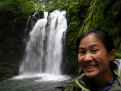
Waterfalls
Majestic Falls

Royal Terrace Falls

Upper Kentucky Falls

Lower Kentucky Falls

N. Fork Smith Falls

I almost stepped on the little guy...

near Sweet Creek Falls

Subscribe to:
Posts (Atom)
